
High-resolution aerial photos and HD video.
Crisp aerial photos and videos capture your site from the same viewpoints over time, creating a clear visual history of progress. Ideal for tracking milestones, reporting to stakeholders, and reducing unnecessary site visits.
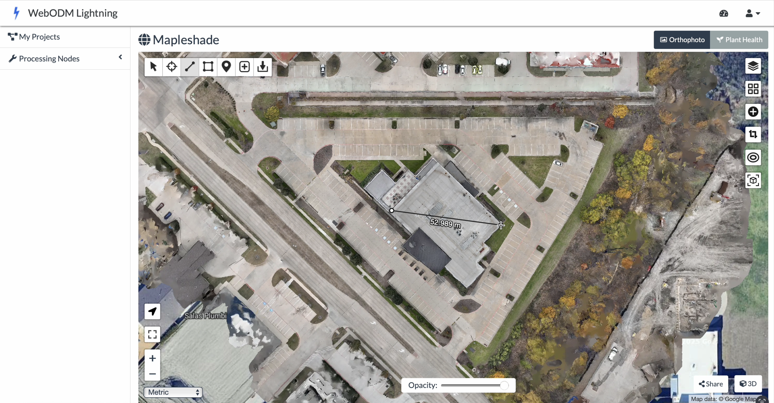
2D Orthomosaic site maps
2D mapping creates a clear, up-to-date overhead map of your site that can be measured and shared. It’s an efficient way to document progress, confirm site conditions, and keep everyone on the same page.
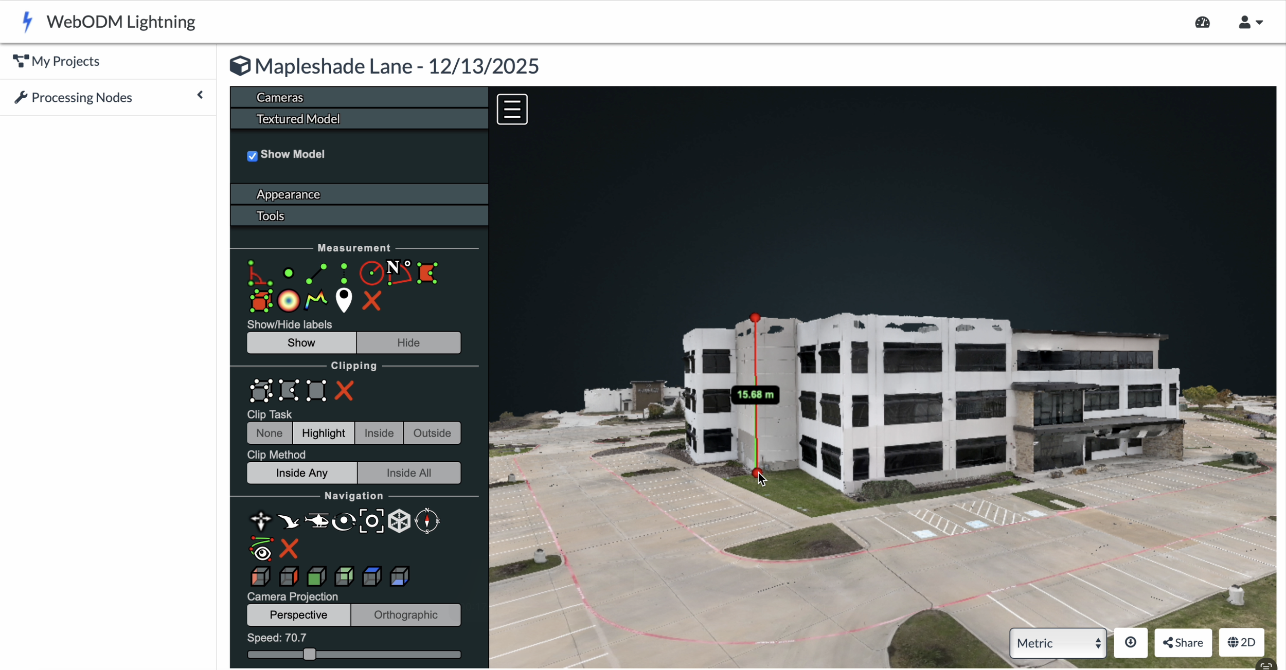
3D site maps
3D mapping creates a detailed, measurable model of your site that can be viewed from any angle. It’s useful for visualizing progress, understanding elevation changes, and documenting complex areas that are hard to assess from the ground.